Chester's streets, railway land, canal and riverside through 8 selected historic Ordnance Survey sheets.
Your business.
Framed in history.
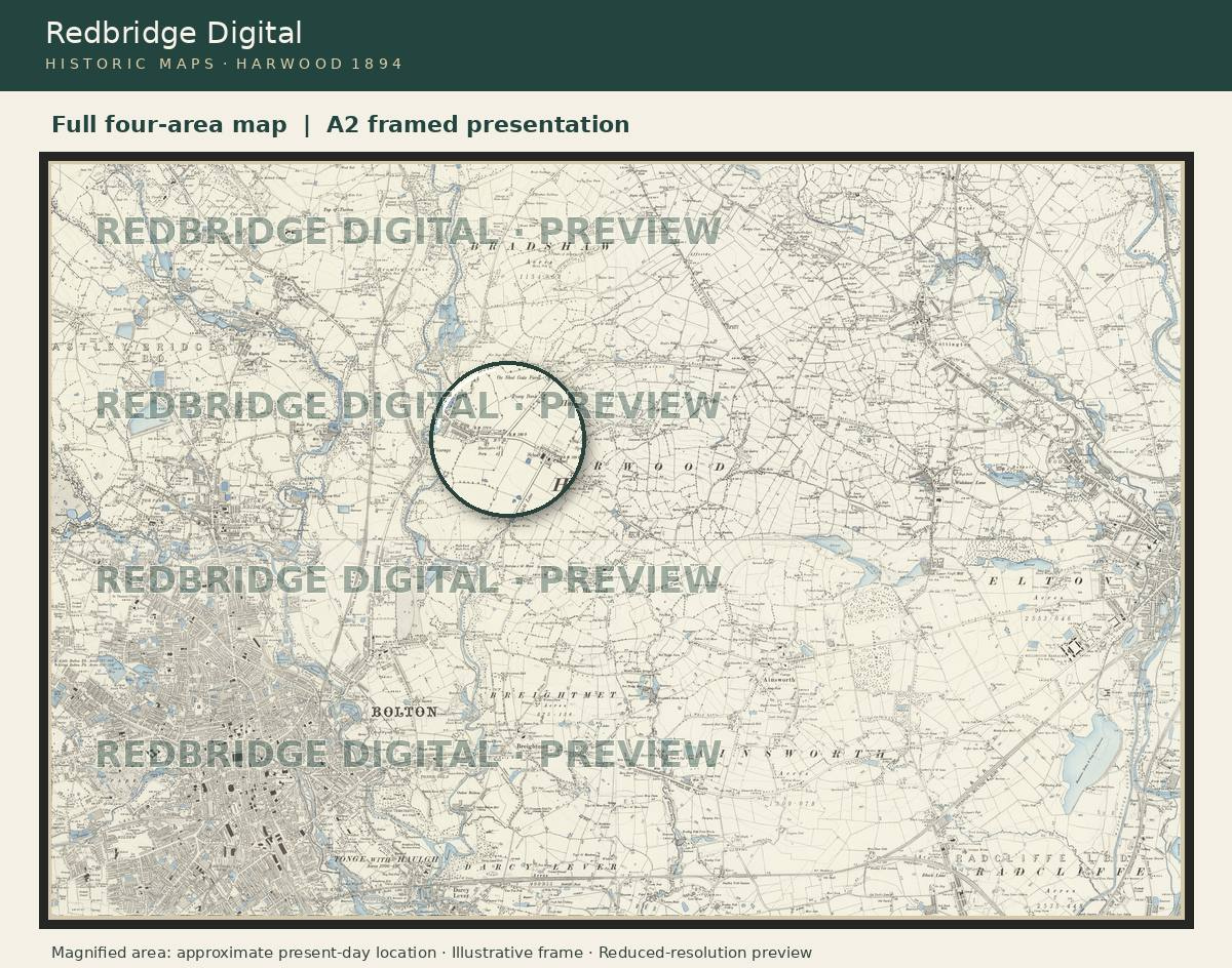
Your premises today, or the place where it began. Four adjoining historic map areas, brought together in one personalised A2 framed picture.
Your map proof is approved before printing. Historic dates and available detail vary by place.

Harwood example · Illustrative frame · Map imagery: National Library of Scotland, CC BY 4.0
A familiar place.
A different time.
From market streets to mill towns,
there’s more to every place than meets the eye.
Digital prices cover the complete map edition and its history guide. Map sheets come together in PDF books; prints and frames are separate.
Location access is optional. We use an approximate location for this search only. Postcodes are sent to Postcodes.io when you search.
Kendal’s yards, canal basin, castle, Holy Trinity and Abbot Hall through eight selected historic Ordnance Survey scans.
Congleton's markets, parks, river mills and silk industry through 13 selected historic Ordnance Survey sheets.
Carlisle’s castle, cathedral, Tullie House, streets and river crossings through eight selected historic Ordnance Survey scans.
Northwich's salt works, market streets, railway and rivers through 9 selected historic Ordnance Survey sheets.
Birkenhead's parks, docks, shipbuilding and civic streets through 11 selected historic Ordnance Survey sheets.

Illustrative black-frame example · Map imagery: National Library of Scotland, CC BY 4.0
A piece of history
for your business.
Four adjoining historic map areas, a subtle magnifying-glass detail at your site and one A2 landscape print. Professionally printed and framed, ready for your wall.
Both: 34mm wooden frame profile, clear acrylic front and backing board. Oak Finish is oak veneer. A2 print: 59.4 × 42cm; the outside frame is larger. No separate mount.
- 01Choose your finish and order£149 including UK delivery. Supply your business name, address and postcode.
- 02Approve your map proofWe confirm the site, available map dates and layout before printing.
- 03Receive your framed pictureEstimated delivery 10–15 working days after approval.
Behind every map,
there’s a story.
A pub. A landlady.
A welcome home worth remembering.
In the Billinge history booklet, a family recollection brings the Hare and Hounds to life: the owner’s great-gran, its landlady, gave the men free beer when they returned from the war.
Small stories like this are why we look closer. Our maps and accompanying guides help you explore the history of a place, and make room for your own discoveries.
A little history,
always to hand.
Explore on your iPad, save the places you love, and come back whenever curiosity calls.
Made for browsing on tablet, phone and desktop.
Good to know.
What do I receive with a digital edition?
Each town edition combines historic maps with a local-history guide as PDF downloads. The Billinge edition contains its 1894 map and a history booklet. The individual edition page explains what is included. Prints and frames are separate.
Can you find a map of any UK address?
We check each request. Our national catalogue index helps us find historic map sources, but the dates and level of detail vary. A postcode is an approximate point; we confirm the exact place and available original map before offering a print.
What does the £149 framed map include?
One personalised A2 landscape print combining four adjoining historic map areas, a magnifying-glass detail, a Classic Black or Oak Finish frame with acrylic glazing, and UK delivery. A proof and one layout adjustment are included. No digital purchase is required.
Will I see my map before it is printed?
Yes. We email a proof showing your location, available map dates and layout for approval before printing. If suitable four-map coverage is unavailable, we refund your order before production. You can ask for a map check before buying. Website frame images are labelled illustrations.